

Text size:
Fortes de São Sebastião PR5TER
How to get there
From the centre of São Sebastião parish, follow the signs to “Farol das Contendas” and, after arriving at the lighthouse, follow the municipal road 509, keeping it to your right. After about 450 metres, you will find the sign marking the beginning of the trail.
It is situated about 15 kilometres, by road, from the centre of Angra do Heroísmo.
Recommended gear
Appropriate footwear for walking, waterproof jacket, hat, sunscreen and water.

Gallery
This path partially develops in the Ponta das Contendas Protected Area for the Management of Habitats or Species, also classified as Special Protection Zone (SPA) within the Natura 2000 network.
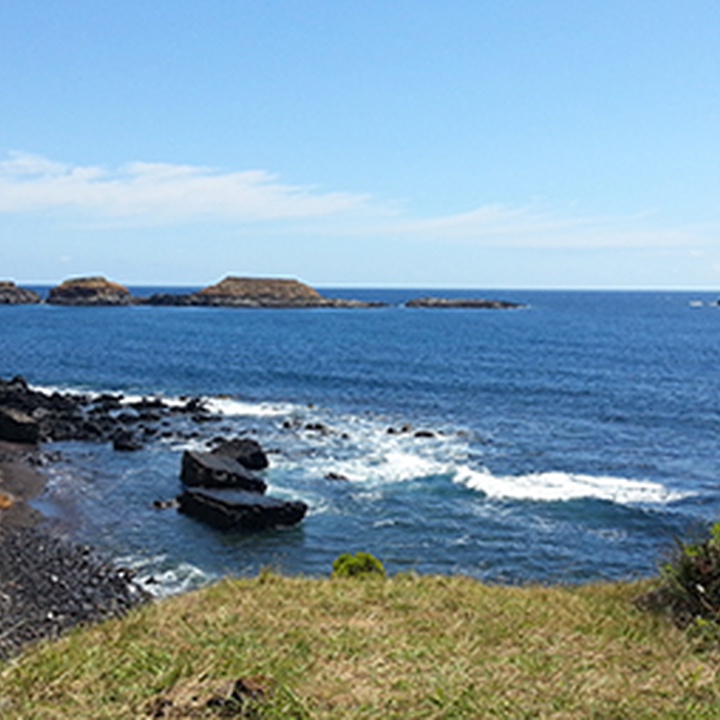
Located in the volcanic massif of Cinco Picos, this small route travels along the Southeast coast of the island, passing by remains of ancient maritime defensive forts (16th and 17th centuries) and ending in the São Sebastião Village.
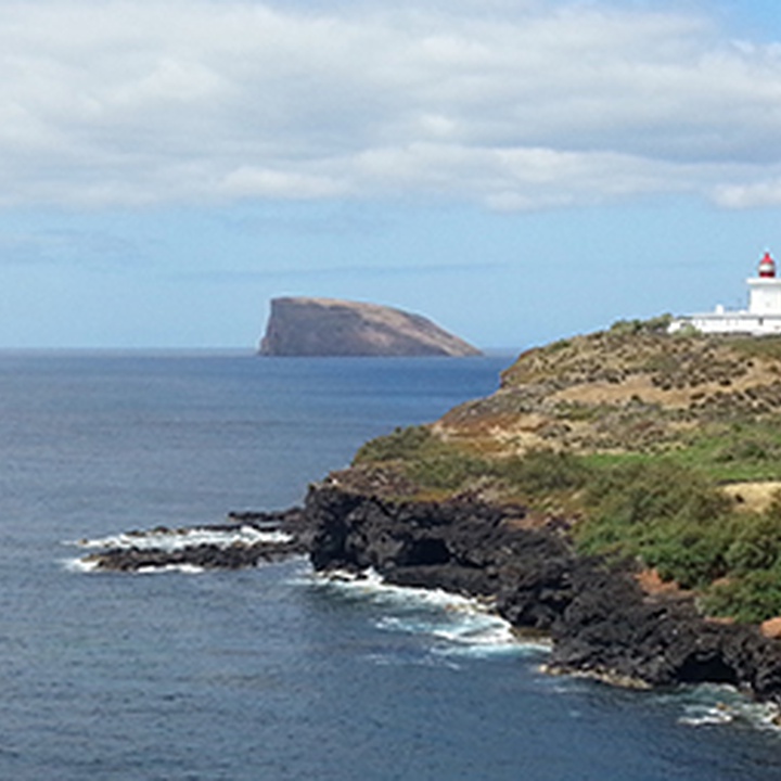
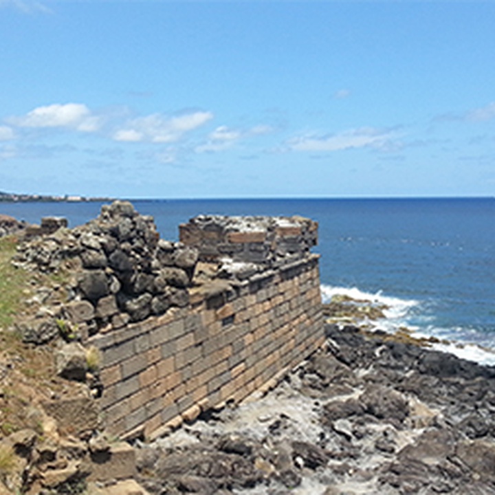
Start the trail on the regional road to the tip of Contendas and continue towards a viewpoint overlooking the Contendas Lighthouse and the Ilhéus das Cabras (islets). Continue towards the remains of the Greta Fort and those of the Santa Catarina das Mós Fort (both from 1581). Contemplate Mós Bay where, in 1583, the navy of Filipe II of Spain deployed and ended the local resistance to the Spanish domain.
Return to the starting point of the trail, turn right and continue along the asphalt road (about 550 metres) until you come to a gate, which you must cross using the existing staircase.
When you reach Pico dos Cernos, turn right towards the ruins of Bom Jesus Fort, built in 1644, where you can contemplate the three islets formed by maritime erosion of an ancient peninsula and an colony of terns (Sterna sp). In the adjacent sea-cliffs nest Cory’s Shearwaters (Calonectris borealis).
Resume the trail towards the ascent of Pico dos Cernos and continue through native vegetation with species such as Tree Heat (Erica azorica) and Azorean Fire Tree (Morella faya).
Continue the trail through a pasture in direction to a geodesic landmark. From this highest point, overlooking Mina Islet, you can see a significant part of the trail.
Continue the walk downhill through a pasture with the cliff on the right and African Tamarisk (Tamarix africana) on the left. Take the opportunity to look back and enjoy the view of the Mina Islet. Further ahead, the African Tamarisks give way to Giant Reeds (Arundo donax), and the trail enters a dirt path leading to fields of cultivation and grazing. Follow the signs until you reach the detour to a viewpoint from where you can see the São Sebastião coastline.
Return to the main path and continue, on the right, by the sea until you reach the Pesqueiro dos Meninos Fort, dating from 1581, with a privileged view of the coastline. From here, the trail goes up to São Sebastião village, passing a rebuilt ancient water mill, goes up the Arrabalde, where the Frei João Stream used to flow and, already inside the parish, passes the Chapel of Nossa Senhora da Graça.
A little further on, you will cross the Largo da Fonte, followed by the Chapel of Sant'Ana. After the church, you will see the central square, where the trail ends.