

Text size:
Vinhas dos Biscoitos
How to get there
The trail begins by the public fountain and washing site at the intersection of Regional Road 1-1 with Rua Longa (a street in Biscoitos parish). It is located about 19 kilometres by road from the centre of Angra do Heroísmo.
Recommended gear
Appropriate footwear for walking, waterproof jacket, hat, sunscreen and water.

Gallery
This trail runs through the Vinhas dos Biscoitos Protected Landscape Area, beginning in the public fountain, at the intersection of the Regional Road 1-1 with the Rua Longa (street), in Biscoitos parish.
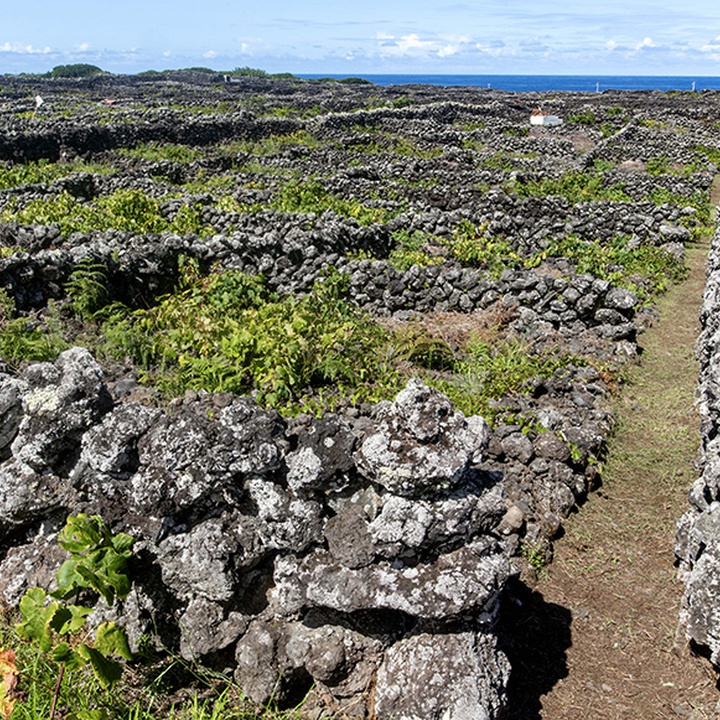
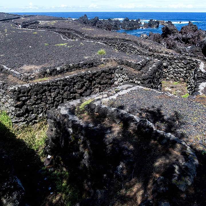
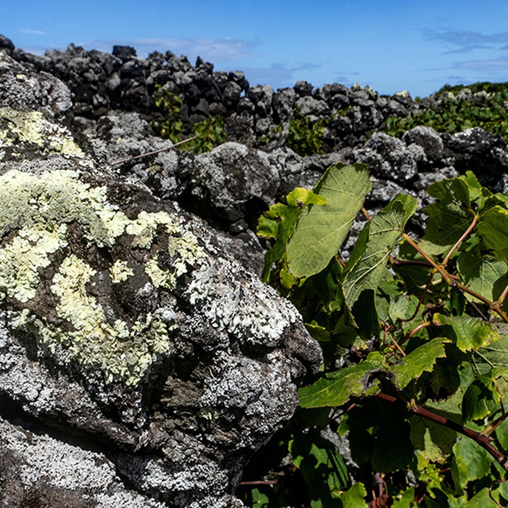
From the 16ᵗʰ century to the present day, Verdelho wine is produced in this area, in a landscape of “curraletas” (small plots delimited by stoned-walls) built by man. This landscape demonstrates how well man knew how to transform infertile land with severe humidity and salinity conditions and rocky basalt soil into generous soil for producing vines. Complement this tour with a visit to the Museu do Vinho (wine museum), where all construction modes and techniques of this landscape and its history are very well interpreted.
Stating near the fountain, walk up a small path to the Rua Longa Viewpoint and return to the starting point to begin the course of Canada da Rua Longa (path), on the end of which you will come across Baía do Rolo (bay). Here, the products were shipped on vessels from Africa and India. Continue straight along Caminho do Mar (path) until you reach the bathing area and pass by the fishing port, also a whaling port. Turn right, passing Forte do Porto, following the Caminho do Canto do Feno for 1 kilometre. Notice some of the coastal species of the natural vegetation of the Azores, adapted to the sea rock and salinity. Then turn left, passing a reed field and entering the vineyards. Look closely at the “curraletas”, seeing the den where the vines are planted, protected from salty winds by the walls and enjoying the temperature that the black stone offers.
The end of this trail takes you to the Canada das Vinhas (path), which you should follow until the Canada da Salga (path), where you turn left. Turn right at the end of the path, following the Canada de Santo António (path). Walk along it, passing the hermitage of the same name, until you reach the car park. Cross it and continue straight for a trail, re-entering the vine plots. Notice the abandoned vineyards that still retain the “curralets” structure. Follow to Canada Brás da Silva (path) and, through it, re-enter the vineyards to observe the organization of plots in "tornas", rows of plots connected by a path. This vineyard section ends at the Ribeira do Chamusco (stream), an ancient form of water supply and access road to the bay. Turning left, go along this stream until you find the Baía do Rolo (bay) again. Turn right, follow the Caminho do Mar (path) to the starting point.