

Text size:
Ponta da Barca
Protected Area for the Management of Habitats or Species

Gallery
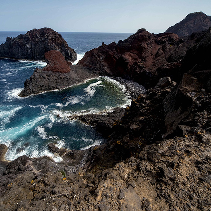
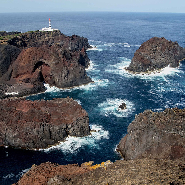
Located on the northwest end of the island, this area with 41.97 hectares, corresponds to a coastal strip, stretching from Calhau Miúdo to Barro Vermelho, and various islets.
It is mainly composed of pebble beaches and very steep sea-cliffs, with maximum altitudes of about 90 metres, showing several recesses and detritic areas with caves. It also presents vegetation of the Macaronesian coasts and permanent vegetation of pebble coasts.
This area is characterized by being a low-level zone and by the existence of about 30 scoria cones and associated lava flows, where basaltic s.l. materials are abundant.
Here, the marine erosion highly affected the vents feeding system of the existing scoria and tuff cones, exposing their dyke systems and volcanic necks. Ilhéu da Baleia is a basaltic neck with prismatic jointing that, by resisting the erosion, exhibits the shape of the animal that gives it its name (whale islet).
Ilhéu da Baleia and Ponta da Barca are a geosite of the Azores UNESCO Global Geopark.
Regarding coastal flora, it is possible to find native Azorean species such as Azorean Coastal Fescue (Festuca petraea), Azorean Sandspurry (Spergularia azorica), Azorean Goldenrod (Solidago azorica) and Azorean Wild Carrot (Daucus carota subsp. azoricus).
Of the seabirds typical of this place, stand out the Monteiro's Storm-petrel (Hydrobates monteiroi), the Cory's Shearwater (Calonectris borealis), the Barolo Shearwater (Puffinus lherminieri baroli), the Madeiran Storm-petrel (Hydrobates castro) and the Common Tern (Sterna hirundo).
This protected area integrates the Ilhéu da Baleia e Ponta da Barca Important Bird and Biodiversity Area (IBA), of the BirdLife International organization.