

Text size:
Grand Route 02 - Stage 2: Santo Amaro – Fajã dos Cubres
How to get there
Leaving the Velas village, at the roundabout follow the indication Calheta in the east direction. After the roundabout, on the regional road, travel about 1.80 kilometres. At the crossroads, turn left towards Santo Amaro. Go up about 0.80 kilometres and arriving at the Parish Church, located on the left side, you will reach the point where the trail begins.
Recommended gear
Appropriate footwear for walking, waterproof jacket, hat, sunscreen and water.

This great route covers approximately half of the island, in a linear trail that connects the Ponta dos Rosais (the western point of the island) to Fajã dos Cubres (on the north coast). It has an extension of 51.8 kilometres.
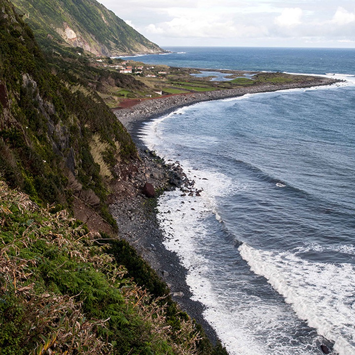
This is a trail that alternates between the plateau of the interior part of the island, where the volcanic cones that generated the island were born, with the steep and very high slopes that come to an end in small flat areas at the sea level, the famous landscapes of the Fajãs of São Jorge.
This great rout is divided into two stages, of approximately 22 kilometres and 30 kilometres respectively. Stage 2 connects Santo Amaro parish (South coast) to Fajã dos Cubres (North coast), crossing the Pico da Esperança e Planalto Central Protected Area for the Management of Habitats or Species, the Fajãs do Norte Protected Landscape Island and the Ponta dos Rosais Natural Monument. It also passes by the Cordilheira Vulcânica Central and Fajã dos Cubres geosites.
Saia da freguesia de Santo Amaro em direção à cordilheira central da ilha, atravessando alguns cones vulcânicos até atingir a Reserva Florestal de Recreio das Macelas, onde pode visitar o Miradouro do Canal com vista para o Pico e Faial.
Siga a sinalética pela estrada e alguns atalhos até atingir o painel do PR 04 SJO – Pico do Pedro/Fajã do Ouvidor. Daqui irá transpor diversos picos desta cordilheira como o Pico do Pedro, do Carvão, da Junça, Verde e o Morro Pelado. Adiante passa pelo Pico da Esperança, que com 1053 metros de altitude é o ponto mais alto da ilha. Esta fase em altitude termina após passar o Pico do Areeiro e adiante, pelo Pico Pinheiro, ambos com lagoas no interior das suas crateras.
Já do lado norte da ilha, siga por uma mata onde poderá encontrar algumas espécies de flora endémica como a urze (Erica azorica), o azevinho (Ilex azorica) e o cedro-do-mato (Juniperus brevifolia), até atingir a freguesia do Norte Pequeno. Prossiga, cautelosamente, ao longo da estrada até à Fajã dos Cubres, onde a etapa termina junto à Ermida de Nossa Senhora de Lourdes.