

Text size:
Great Route 01 - Stage 1: Topo – Fajã dos Vimes
How to get there
Leaving Calheta village, follow the Regional Road 2-2 until you reach the Calheta Health Centre and turn to your right to Topo. Still on the Regional Road, go about 25 kilometres in an easterly direction until the entrance of Topo. Next to Bombeiros Voluntários do Topo, turn left towards Pontinha do Topo, where you will find a car park and where the trail begins.
Recommended gear
Appropriate footwear for walking, waterproof jacket, hat, sunscreen and water.

This great route covers approximately half of the island in a linear route that connects the parish of Topo with the Fajã dos Cubres on the north coast. It has 39.2 kilometres and crosses the Fajãs do Norte Protected Landscape Island.
This is a trail that alternates between the plateau of the interior part of the island, where the volcanic cones that generated the island were born, with the steep and very high slopes that come to an end in small flat areas at the sea level, the famous landscapes of the Fajãs of São Jorge.
This great trail is divided into two stages, of approximately 25 kilometres and 15 kilometres, respectively. You should plan your route according to your physical condition, interest and availability.
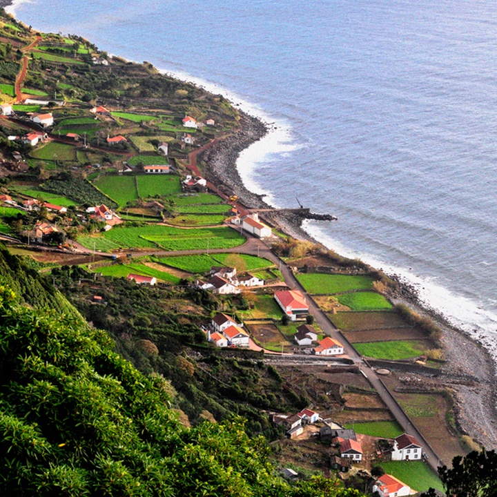
Stage 1 connects the Topo parish to Fajã dos Vimes, along a length of 25 kilometres, going through geosites of Ponta e Ilhéu do Topo and the one of Arriba das Fajãs dos Bodes e São João.
Begin this stage near the lighthouse of Ponta do Topo, with a view over the Topo Islet and the island of Terceira. Follow the marks near the coast until the centre of the parish, passing by the convent Franciscan Convent of São Diogo. Here, it is possible to make a short detour to the recreational harbour, passing by the house Casa dos Tiagos, building from the 19th century and classified as public interest. On the way back, cross an old Whale Watching tower, being nowadays a viewpoint.
The path through the South coast will pass by Santo Antão, São Tomé and goes down the road of Saramagueira until Fajã of São João, a place of narrow streets and traditional Portuguese cobbled street. Pass the church in the direction of Lourais, crossing small agricultural fields that, along the climb, give way to woods. Before Lourais, cross the stream of Salto and the locality and proceed, on a descending sense, through a dirt road towards Fajã dos Bodes.
Continue the trail with a view of the islands of Pico and Faial, Fajã dos Bodes, Vimes and the village of Calheta. Arriving at Fajã dos Bodes, follow the marks near the coast until reaching Fajã dos Vimes. Go down the road until the recreational harbour, the place where this stage ends and where you can go for a swim.
In the interior of the fajã, you can visit the handicraft workshop where the traditional quilts are made and taste a coffee locally produced.
The next stage of the Great Route begins here, connecting Fajã dos Vimes to Fajã dos Cubres.