

Text size:
Fajãs do Norte
Protected Landscape Area

Gallery
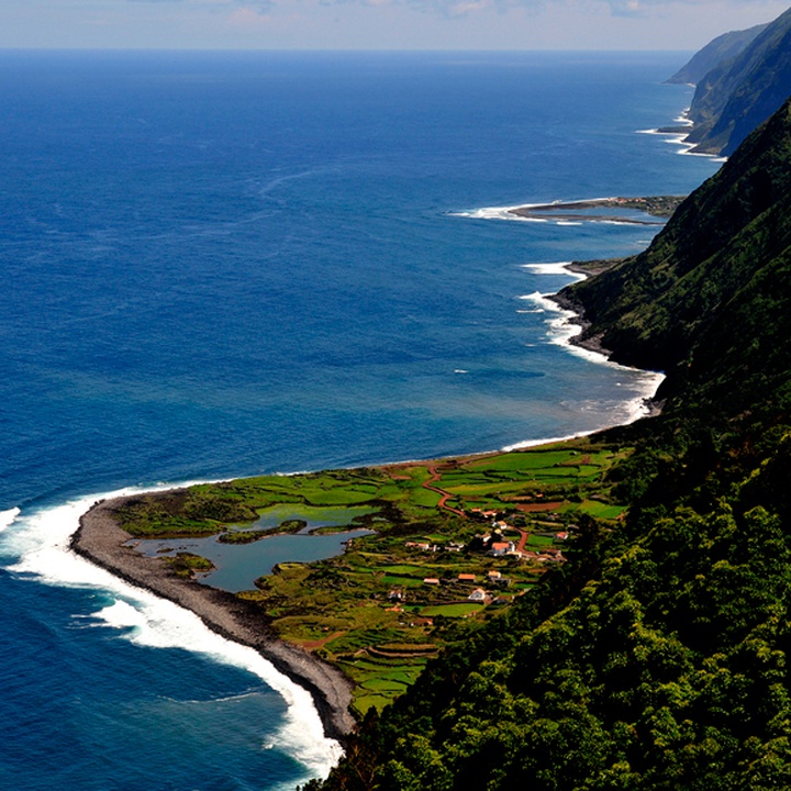
Extending along the northeast coast of São Jorge, this protected area comprises about 2,926 hectares and begins at the stream mouth that flows west of Fajã Isabel Pereira and ends at the Costa do Topo Protected Area for the Management of Habitats or Species.
This protected area is composed of sea-cliffs with heights between 300 and 700 metres and several fajãs, mostly detritic platforms, as the fajãs of Cubres, Belo and Caldeira de Santo Cristo. There are also three lava deltas in this area, namely the fajãs of Ribeira d'Areia, Ouvidor and Pontas.
On these fajãs, it is possible to observe various species of seabirds or waterbirds and fish, as well as endemic flora from the Azores.
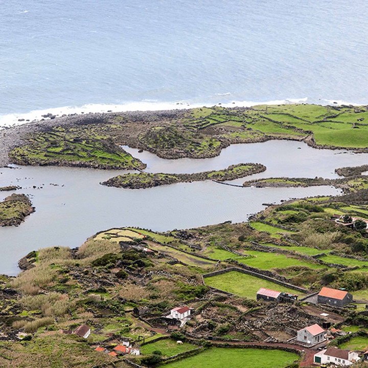
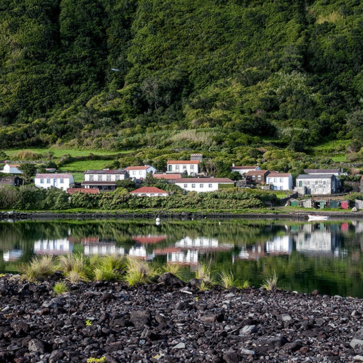
Fajã da Caldeira de Santo Cristo is a detritic platform formed by materials that resulted from slope movements (such as rockfalls, landslides and slumps), which significantly increased due to slope movements during the earthquake of 9 July 1757. The erosive action of the sea, the rainwater and the surface water runoff probably originated its unique coastal lagoon, separated from the sea by a pebble beach but linked directly to it through a tidal influx built by Man.
In the coastal lagoon of Caldeira de Santo Cristo lives the only commercially exploited clam population (Ruditapes decussatus) in the Azores. Due to the great protection that the lagoon offers from the sea conditions, it is a maternity zone for several marine fish such as the Dusky Grouper (Epinephelus marginatus), the Island Grouper (Mycteroperca fusca) and the Thicklip Grey Mullet (Chelon labrosus).
As the Fajã da Caldeira de Santo Cristo, the Fajã dos Cubres is a detritic platform and together they constitute the only coastal lagoon system in the Azores, a priority and protected habitat. The coastal lagoon of Fajã dos Cubres does not communicate directly with the sea, which influences its hydrodynamics.
The name of this fajã is related to the abundance of a plant with small yellow flowers, the Azorean Goldenrod (Solidago azorica) (cubres in Portuguese).
In turn, the Fajã da Ribeira d'Areia together with Fajã do Ouvidor and Fajã das Pontas are the only lava deltas on the north coast of the island. They were originated from basaltic lava flows emitted from the central volcanic ridge, associated with volcanic eruptions that occurred in the last 10 thousand years and reached the coastline spreading at its base.
Here, the fossil cliff (located before Fajã da Ribeira d'Areia and evidence of the coastline existent before the volcanic eruption that originated the lava delta) reaches about 280 metres of altitude. Along the coast, it is possible to observe ropy lavas, coastal caves (from marine erosion) and several well-preserved lava arches, such as the Arco da Fajã da Ribeira d'Areia.
This zone allows to observe species of migratory birds such as the Grey Heron (Ardea cinerea), the Grey Heron (Egretta garzetta), the Coot (Fulica atra), the Common Snipe (Gallinago gallinago), the Common Greenshank (Tringa nebularia), the Mallard (Anas platyrhynchos), the Whimbrel (Numenius phaeopus) and, more rarely, the Ardea purpurea.
It is also possible to observe seabirds, such as the Cory´s Shearwater (Calonectris borealis), the Common Tern (Sterna hirundo) and the Roseate Tern (Sterna dougallii), and terrestrial birds, such as the Azores Wood Pigeon (Columba palumbus azorica), the Azores Chaffinch (Fringilla moreletti) and the Azores Grey Wagtail (Motacilla cinerea patriciae).
In terms of flora, are noteworthy the Ruppia maritima (the only maritime vascular plant registered to the Azores), the Azorean Heather (Erica azorica), the Azorean Coastal Spurge (Euphorbia azorica), the Sharp-pointed Rush (Juncus acutus), the Azorean Sandspurry (Spergularia azorica), the Sea Spleenwort (Asplenium marinum), the Sea Fennel (Crithmum maritimum), the Azorean Coastal Fescue (Festuca petraea), the Short Leafed Juniper (Juniperus brevifolia) and the Azorean Picconia (Picconia azorica), and the native species Firetree (Morella faya).
The Serra do Topo - Caldeira de Santo Cristo - Fajã dos Cubres walking trail (PR01SJO) is a great option to visit this place and enjoy the beautiful landscapes.
This protected area integrates the Costa Noroeste e Ponta do Topo Special Area of Conservation (SAC) within the Natura 2000 network. It is classified as a Ramsar Site under the Ramsar Convention and a geosite of the Azores UNESCO Global Geopark.