Text size:
Entre Montes PRC08FAI
How to get there
From the Garden of Praça do Infante (south end of the city’s Main Avenue), in front of Marina of Horta, go south through the traditional cobblestone path towards the Porto Pim Beach. After passing the Hotel Canal on your right, turn left at the next intersection and walk about 600 metres until you reach the car park at the left of the whaling station.
Recommended gear
Appropriate footwear for walking, waterproof jacket, hat, sunscreen and water.


This trail is integrated into de Monto da Guia Protected Landscape Area and begins and ends at the car park near Porto Pim Beach.
It passes between the Monte da Guia and Monte Queimado (hills), places of great local historical importance, and goes through some viewpoints.
During the spring and summer seasons, it is possible to observe some Azorean seabird species as the Calonectris borealis and the Sterna hirundo, because, during these seasons, these birds migrate to the Archipelago to nest. Along the trail, the Erica azorica, the Morella faya, the Festuca petraea and the Juncus acutus dominate the landscape.
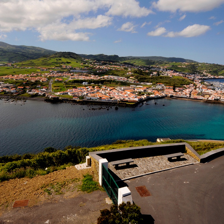
Start the trail near the Porto Pim Beach’s car park. Pass the Observatório do Mar dos Açores (Azores Sea Observatory) on your right and follow the traditional cobblestone path until the steps on the left that lead to the Lira Viewpoint. From this point, it is possible to see the bay and the Fortress of São Sebastião on the opposite margin. Along the trail, there are some maritime protection fortifications of the 16th and 17th centuries, which is why the place was named Porto Pim, a word of Flemish origin that means Safe Port.
From the Lira Viewpoint, go up to the road where you should turn right, passing through the Nossa Senhora da Guia Chapel. Continue south, with Caldeirinhas on your left (Monte da Guia submarine volcano´s craters), until the path turns north, overlooking the beach. Pass the Porto Pim Aquarium, an exhibition place of the most common species of the Azorean sea, and then by the Dabney’s House that belonged to the Dabney family who lived here between 1806 and 1894, leaving a vast built heritage, recovered by the Government of the Azores.
Then follow to the left, crossing the beach and, at its end, turn right to the Rua da Rosa (street). Almost at the top of the street, you will find trail signs on the right that will take you to the summit of Monte Queimado, a terrestrial genesis volcano. Before reaching the mountaintop, take the opportunity to rest and enjoy the view over the marina of Horta.
The trail continues to the car park, where it started.

