

Text size:
Dez Vulcões PR06FAI
How to get there
Leaving from Largo Duque D’Ávila e Bolama, in the centre of Horta city, in front of the City Hall, head north towards Flamengos parish and follow the signs indicating the “Caldeira”.
Recommended gear
Appropriate footwear for walking, waterproof jacket, hat, sunscreen and water.

Gallery
The trail starts at the Caldeira Viewpoint and ends at the Capelinhos Volcano Interpretation Centre (Capelo parish).
Beginning at the Caldeira do Faial Nature Reserve, this trail runs through the Zona Central Protected Landscape Area and the Capelinhos, Costa Norte e Varadouro Protected Area for the Management of Habitats or Species, ending at the Vulcão dos Capelinhos Natural Monument.
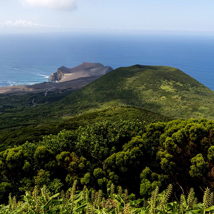
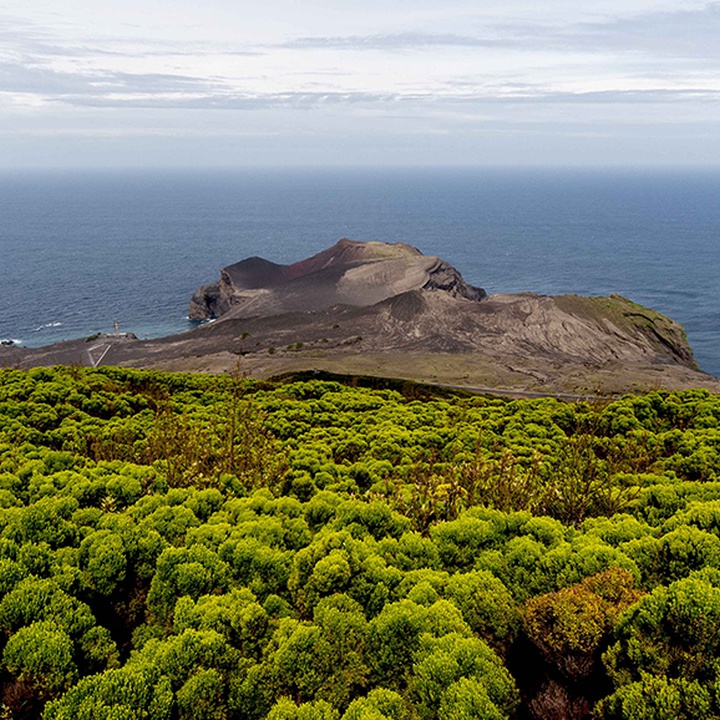
Along the walk it is notorious the origin of the island with passage in the geosites of Caldeira, Península of Capelo and Vulcão dos Capelinhos e Costado da Nau.
This trail combines three segments of existing trails in Faial: Caldeira, Levada and Cabeço do Canto. The trail starts at the Caldeira (caldera) and runs through, as its name suggests, 10 of the existing volcanoes in the fissured alignment of Capelo Peninsula. Biodiversity and geodiversity are a constant in this trail, highlighting the landscapes of Capelo Peninsula and the old Capelinhos Lighthouse, on an authentic lunar setting where it is possible to step on land formed by ash, tuff and volcanic bombs.
This trail has an unevenness of about 1000 metres, enabling us to discover much of the Azorean endemic flora from altitude examples through the medium altitude and features species of ravines and sheltered places.
Start the trail at the Caldeira Viewpoint and, before starting, cross the tunnel overlooking the inside of the crater. The trail skirts the Caldeira and, before the ascent to Cabeço Gordo, it continues to the right, heading towards the area of the CapelinhosVolcano.
Descend the western slope of the island until you reach a dirt road to Cabeço dos Trinta. Along the walk, you will have the opportunity to observe several examples of typical flora of the Laurel Forest, as well as some birds of the Azores.
When you pass the water storage tank, you may choose to make a detour through the access tunnel to Cabeço dos Trinta. Back on the trail, descend along woods and forest paths until you reach the Cabeço do Fogo Viewpoint. In addition to the view, this hill contains patches of native vegetation and is a significant nesting area for the Columba palumbus azorica.
The trail continues through woodland, areas of cultivated fields and pastures, passing through Furna Ruim, Algar do Caldeirão and Cabeço do Canto until you reach the road to Capelinhos that you must cross carefully. Enjoy the scenery before you, dominated by volcanic ash from the 1957/1958 eruption, which added 2.4 km2 to the island. Continue towards the car park of the Capelinhos Volcano Interpretation Centre, where the trail ends.