

Text size:
Rumo ao Morro de Castelo Branco PRC05FAI
How to get there
Leaving from Horta city towards the west, take the Regional Road to Castelo Branco parish. When you reach the place of Lombega, pay attention to your left to find the trail’s indication.
Recommended gear
Appropriate footwear for walking, waterproof jacket, hat, sunscreen and water.

Gallery
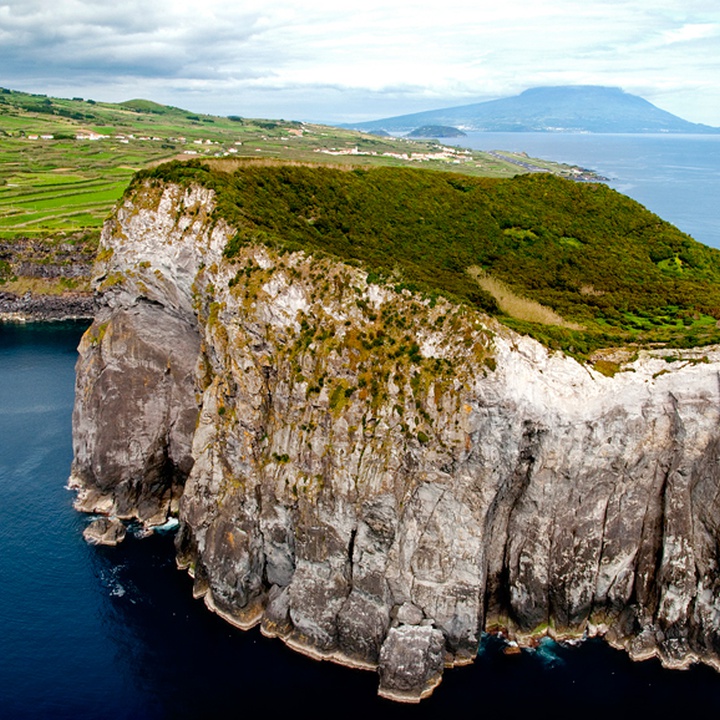
The trail begins and ends on the place of Lombega, in Castelo Branco parish, and is partially inserted in the Varadouro – Castelo Branco Protected Area for the Management of Habitats or Species and the Morro de Castelo Branco Nature Reserve.
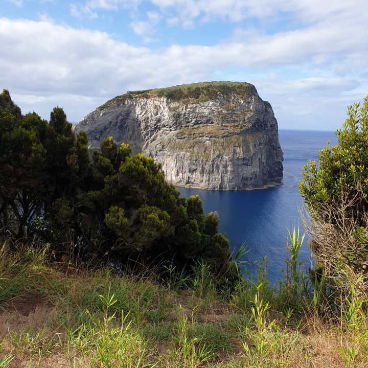
Along the trail, you can observe some of the most important seabirds of the Azores and the Morro de Castelo Branco trachytic dome, a geosite of the Azores UNESCO Global Geopark. You can also find examples of rare and protected flora species, such as Myosotis maritima and Erica azorica.
Start the trail in Lombega, next to the regional road and continue along it, passing a coffee shop, where you can stop for refreshments. Follow the signposts to the left, along a dirt track which leads to cultivated fields, until you reach the cliff. Continue along the cliffs among examples of Erica azorica, Morella faya and Arundo donax.
Pass by the viewpoint to enjoy the view, on the right, to the youngest part of the island, the Capelinhos area.
Ahead is the Morro de Castelo Branco, the result of a coastal volcanic eruption about 30 thousand years ago and an important nesting site for some seabird species such as the Calonnectris borealis, the Sterna hirundo, the Sterna dougallii and the Puffinus baroli. When reaching a gate, choose the detour on your right end side, towards Morro, and before the end of the road, almost at the end of the path, enjoy the view to the east, to the island of Pico.
From here, the trail continues along the same path until the gate, where you should turn right and then left along an asphalted road, which provides access to cultivated fields and pastures. This path continues to the regional road, where the trail ends.