

Text size:
Vulcão dos Capelinhos
Natural Monument

With about 125 hectares, this Natural Monument extends from the basaltic rocks of the southwest tip of Porto do Comprido harbour until Costado da Nau.
It was classified due to its aesthetic and natural values, namely the geological singularity and biodiversity associated with protected species and habitats, as well as the expressive cultural and historical component of the Capelinhos Volcano eruption.
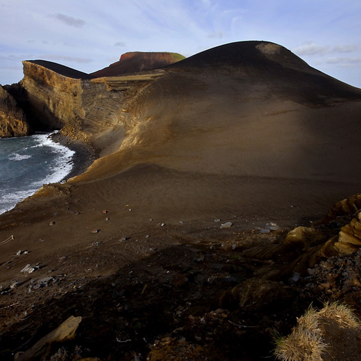
The landscape's natural evolution is due to the presence of geomorphological elements of great representativity, as well as the possibility to observe different volcanic products of the different eruptive phases.
The Capelinhos Volcano became a volcanological historic mark when, between 1957 and 1958, an eruption occurred on the sea, at about 1 kilometre from the northwest coast of Faial Island, at a maximum depth of 60 metres. During its 13 months of activity, this volcano had two distinct phases: the submarine, characterised by big explosions with emission of ash jets, steam columns and other gases; and the subaerial, with the projection of larger pyroclasts and emission of lava flows.
The accumulation of 174 million m³ of the emitted material and the 2,4 km² of created area led to the creation of the “New Lands”, a lunar landscape that rose to an altitude of 160 metres. With the end of the eruption, a new process of landscape alteration and destruction began immediately as a result of the erosive agents' action.
This area integrates the Caldeira e Capelinhos Special Area of Conservation (SAC) and Special Protection Area (SPA) within the Natura 2000 network, as well as the Vulcão dos Capelinhos e Costado da Nau geosite of the Azores UNESCO Global Geopark.
FOR SAFETY REASONS, ACCESS TO THE CAPELINHOS VOLCANO IS PROHIBITED.