

Text size:
Great Route - Stage 4: Bananeiras - Vila do Porto
How to get there
Follow the Regional Road towards the Lugar das Bananeiras site, in São Pedro parish.
Recommended gear
Appropriate footwear for walking, waterproof jacket, hat, sunscreen and water.

The fourth stage of the Grand Route, with 22,5 km in length along the northwestern coast, connects the Lugar das Bananeiras, parish of São Pedro, to Vila do Porto.
On the way back, the route crosses the Barreiro da Faneca. Another detour to Ponta do Pinheiro offers a privileged view over the north coast of the island. This stage follows toward the Ponta dos Frades, then down to the Anjos, where it goes along the west coast of the island to Vila do Porto, where it ends.
Leave the Lugar das Bananeiras towards Baía do Raposo. In this geosite, you can visit the ruins of two watermills, the watercourse that feeds them and a wine mill belonging to the local vineyards.
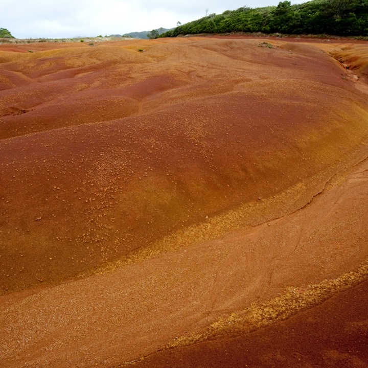
Proceed west, and you will find another geosite, Barreirro da Faneca, a place of the last eruptive phase of the island, where the predominant clay is red. At this stage of the walk, on dry land, there are several detours accessing viewpoints over the north coast.
Follow the marks passing by Monte Gordo until Anjos, the first place on the Archipelago where the Portuguese navigators disembarked, in the 15th century.
Continue along the coastal area, passing by the bathing area of Anjos until you start seeing, on the horizon, the airport. This part of the trail runs along a track through farming fields and common land adjoining the airport fence.
Reaching the end of the airport, follow the mouth of the Ribeira Seca stream, where you will enter a protected area with a privileged view towards the Ilhéu da Vila. The trail ends at the slope, where it is possible to see the commercial harbour and the historical centre of the village of Vila do Porto.