

Text size:
Costa Norte PR01SMA
How to get there
Leaving from Vila do Porto, take the Regional Road towards the parish of São Pedro. In the site of Feteiras de São Pedro, you will find a path to the left, indicated by the panel of the beginning of the trail, which starts the trail.
Recommended gear
Appropriate footwear for walking, waterproof jacket, hat, sunscreen and water.

This linear trail runs along the north coast of Santa Maria, linking Bananeiras to the historic village of Anjos, on a route where geology, natural landscape and cultural heritage intertwine exceptionally.
The route begins at Feteiras de Baixo, next to the regional road, descending along a dirt track which, after a few minutes, leads to the north coast. Here you will find the turn-off to Baía do Raposo, one of the most striking landscapes along the route and part of the Barreiro da Faneca Protected Landscape Area, which is also classified as a geosite within the Azores UNESCO Global Geopark. This bay, once used to access local fishing grounds, still preserves two watermills, the old levada that fed them, and the ruins of a wine press, all testaments to the island’s traditional culture.
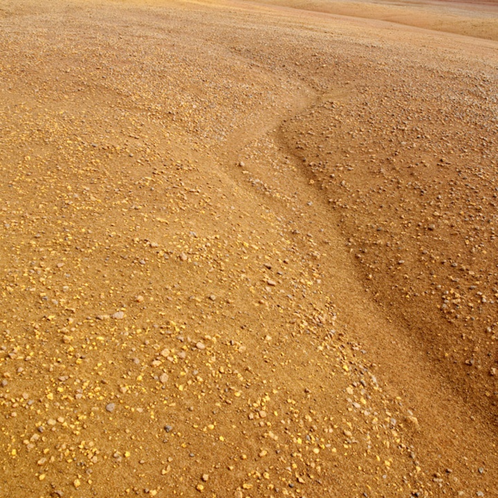
As you leave the bay, head up along the Ribeira do Engenho and enjoy the diversity of native and endemic plant species, such as the Azorean Picconia (Picconia azorica), the Firetree (Morella faya) and the Azorean Pericallis (Pericallis malvifolia). This path is also flanked by introduced species, including Sweet Pittosporum (Pittosporum undulatum), Giant Reed (Arundo donax), and American Agave (Agave americana). Along this stretch, it is common to see or hear various species of birds, such as the Common Buzzard (Buteo buteo rothschildi), the Azores Blackbird (Turdus merula azorensis), the Azores Chaffinch (Fringilla moreletti), the Santa Maria Goldcrest (Regulus regulus sanctaemariae), the Atlantic Canary (Serinus canaria) and the Robin (Erithacus rubecula). Continuing westwards, the trail passes through a dense forest, leading to another geosite, Barreiro da Faneca, the site of the island’s final eruptive phase, where reddish clays predominate. At this stage of the route, across arid terrain, several side paths lead to viewpoints overlooking the north coast, notably Ponta do Pinheiro. At the end of this arid zone, the path leads up to Monte Gordo, where there is a whale-watching post. From here, the route climbs to Ponta dos Frades, then continues parallel to the Ribeira dos Lemos towards Anjos, where the presence of a small chapel marks the history of the settlement of the island of Santa Maria (likely the first Christian church in the Azores) and the statue of the navigator Christopher Columbus, in the centre of the village. In Anjos, visitors can also enjoy the excellent bathing area and, if they wish to extend the experience, continue along the GR 01 SMA – Grande Rota de Santa Maria towards Vila do Porto.