

Text size:
Baía da Maia
Protected Landscape Area
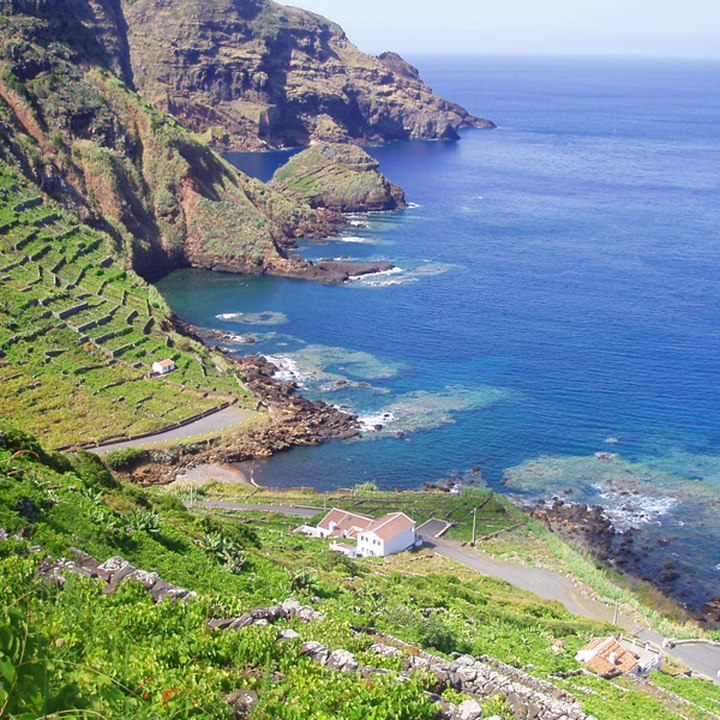

The Baía da Maia protected area, located on the south-east coast of Santa Maria, covers around 55 hectares and stretches between Ponta do Castelete, Baixa da Maia, and Ponta do Castelo.
In addition to its natural value, this area stands out for its strong cultural and scenic features, marked by traditional terraced vineyards and protected by basalt rock ‘quartéis’ (curals) that bear witness to human adaptation to the steep hillside.
At the eastern end of the bay, the Aveiro Waterfall, standing 110 metres tall, stands out as one of the island’s most iconic natural features and is considered the highest vertical waterfall in Portugal. The stream that feeds it descends through an erosion cirque, exposing along the slopes a remarkable succession of volcanic formations, where it is possible to observe subaerial basalt flows with prismatic jointing, and submarine pillow lavas.
The flora of Maia Bay includes several endemic species characteristic of the Azorean coastal areas, notably the Azorean Bellflower (Azorina vidalii), the Azorean Coastal Spurge (Euphorbia azorica) and the Azorean Picconia (Picconia azorica).
The birdlife is equally rich: on the sea cliffs, one can spot the Cory’s Shearwater (Calonectris borealis) and the Common Tern (Sterna hirundo), whilst on land, species such as the Azores Chaffinch (Fringilla moreletti), the Robin (Erithacus rubecula), the Azores Grey Wagtail (Motacilla cinerea patriciae) and the Azores Blackbird (Turdus merula azorensis) are common.
Maia Bay forms part of an Azores UNESCO Global Geopark site and can be explored via the Santo Espírito – Maia walking trail (PR04 SMA) and the Grande Rota de Santa Maria (GR01 SMA), offering visitors a unique combination of natural, geological and cultural heritage.