

Text size:
Costa Sul e Sudoeste
Protected Area for the Management of Habitats or Species
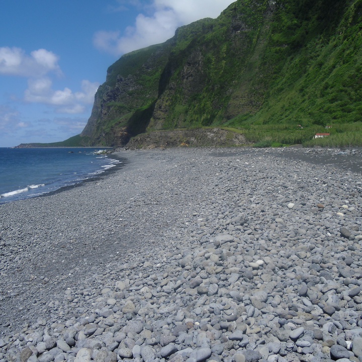

This area has about 497 hectares, a maximum altitude of 550 metres and extends along the south and southwest coast of the island.
Its landscape is marked by steep sea-cliffs alternating with talus-platforms (named fajãs) originated from lava flows and/or from detritic materials, as well as endemic vegetation.
On the southwest sea-cliffs, outcrop old geological formations, of submarine origin and with about 2.5 million years, which are covered by younger geological formations associated with the subsequent subaerial volcanism.
At the south, stand out the Ponta da Rocha Alta (formed in 1980) and the Fajã de Lopo Vaz, detritic platforms that resulted from the landslide of the high and steep adjacent sea-cliffs.
The Lajes das Flores lava delta is constituted by basaltic flows, which moved towards the sea and formed the rocky tip that extends from the lighthouse to the Porto das Lajes (harbour).
On the inaccessible islets and sea-cliffs, occur endemic plants such as the Daucus carota ssp. azoricus, the Euphorbia azorica and the Festuca petraea.
In this protected area, nest important colonies of seabirds, standing out the Calonectris borealis, the Sterna hirundo and the Sterna dougallii.
It is possible to discover this protected area through the Lajedo - Fajã Grande (PR02FLO), the Fajã de Lopo Vaz (PRC04FLO) and the Great Route of Flores (GR01FLO) walking trails.
This area integrates the Costa Sul e Sudoeste Special Protection Area (SPA) within the Natura 2000 network, a geosite of the Azores UNESCO Global Geopark and an Important Bird and Biodiversity Area (IBA) of the BirdLife International organization.