

Text size:
News
Regional Secretariat for the Environment and Climate Change promotes theoretical and practical training on drone piloting for map production
Oct. 26, 2023
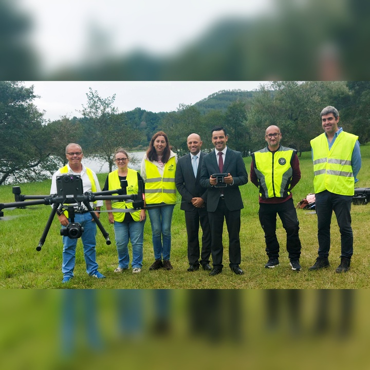
The Regional Secretariat for the Environment and Climate Change organised a practical training session on drone piloting - "Practical Remote Piloting (UAS Handling)," conducted by the company ABSANT Training, which took place in Furnas, São Miguel Island, between October 11 and 19, with a view to providing training for map production.
The Regional Secretary for the Environment and Climate Change, Alonso Miguel also attended one of the training sessions. As part of the Risk Mapping Project for Mitigation and Adaptation to Climate Change, fully funded by REACT-EU, nine multi-rotor drones were purchased for each of the regional Environment and Climate Change Services as well as three quad-rotor drones with LIDAR sensors for the Geodesy, Mapping and Land Registry Division of the Regional Directorate for Spatial Planning and Water Resources, representing an overall investment of about 170 thousand Euros.
"Following this investment, it became necessary to provide training for the Regional Secretariat for the Environment and Climate Change technicians to operate the equipment purchased," he said.
Alonso Miguel emphasised that "the Regional Secretariat for the Environment and Climate Change, in accordance with its organisational structure, has as its mission to define and implement the actions necessary to comply with regional policies regarding map production, land registry and geographic information. The Regional Directorate for Spatial Planning and Water Resources is also responsible for promoting the development of basic and thematic maps in conjunction with other competent entities."
"The Risk Mapping Project for Mitigation and Adaptation to Climate Change has led to a wide range of important investments, including the acquisition of this equipment. It is fundamental for building the capacity of the Autonomous Region of the Azores in the field of map production, with a view to minimising risks arising from the impacts of climate change, making a significant contribution to the protection of people and property," he continued.
Alonso Miguel stated that in order to draw up risk maps for climate change mitigation and adaptation, it is necessary to update the basic information.
He explained: "Three quadcopter drones with photographic sensors and LIDAR technology have been acquired for this purpose, which allow regular aerophotogrammetric surveys to be carried out for map updating. In complementing this information with data from LIDAR equipment, it is possible to obtain highly accurate colour orthoimages as well as digital terrain and elevation models."
"The equipment acquired will allow us, for example, to increase our capacity to monitor protected areas, assess the situation of streams and coastlines and carry out a detailed assessment of built-up areas exposed to risks in the context of extreme events and to create climate change scenarios. Moreover, it will now be possible to obtain georeferenced information to update existing mapping information as well as to carry out topographical surveys for intervention projects in risk areas," he added.
Alonso Miguel also explained that the unmanned aerial equipment that the Autonomous Region of the Azores has acquired will also make it possible, in addition to what has already been mentioned, to determine the growth of biomass so as to quantify the Region's carbon sinks, namely the vegetation cover in forest areas, pastures and, above all, peat soils, whose preservation is of strategic importance in terms of carbon sequestration and, consequently, climate action.
The Regional Secretary added that "detailed mapping is an essential tool for updating and improving Territorial Management Tools, especially with regard to Special Land Management Plans and Municipal Land Management Plans. They are required to follow the guidelines of the Regional Climate Change Programme, as these aspects are essential for adapting the Region to the effects of climate change, and for safeguarding and protecting the populations of the archipelago."